Sri Lanka is a teardrop-shaped island nestled in the Indian Ocean. It’s widely celebrated for its golden beaches, lush tea plantations, and vibrant culture. However, the ordinary tourist often overlooks another side to this magnificent island. For the adventure seeker, Sri Lanka is a land of exhilarating hiking trails. These paths wind through mist-covered mountains, dense rainforests, and sacred peaks.
This underrated hiking paradise is filled with rainforests, waterfalls, and misty mountains. Consequently, this tropical island has something for every hiker. You can find a spiritual sunrise climb or a scenic rainforest ramble. In addition, you can enjoy panoramic views from a rugged peak. It’s a perfect destination for both seasoned trekkers and casual wanderers.
Here is a guide to the best hikes in Sri Lanka. It covers everything from iconic treks like Adam’s Peak to hidden gems deep in the Knuckles Range. As a result, there is something for every type of adventurer. You will also find tips on gear, when to go, and where to stay. This will help you hit the trails fully prepared!
Adam’s Peak (Sri Pada) – A Sacred Sunrise Climb
Location: Central Highlands, near Hatton Distance: Approx. 5 km (one way) Duration: 4 to 6 hours Difficulty: Moderate Best for: Spiritual sunrise, cultural experience
Sri Pada, better known as Adam’s Peak, is one of Sri Lanka’s most iconic hikes. At 2,243 meters, this conical mountain is revered by Buddhists, Hindus, Christians, and Muslims. The summit bears a mysterious footprint-shaped mark. Depending on who you ask, it is believed to be the footprint of the Buddha, Shiva, or Adam.
The Spiritual Journey
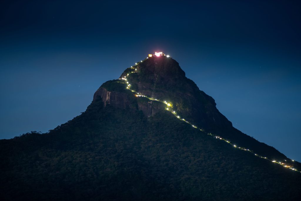
During the pilgrimage season from December to May, thousands of devotees climb the mountain. They hike through the night by torchlight to reach the summit by sunrise. The sight up top is truly magical. For instance, the first golden rays cast a perfect triangular shadow of the peak onto the cloudy valley below.
The trail begins in the village of Nallathanniya, also known as Dalhousie. This trail has over 5,000 steps that wind up through tea estates and dense forests. During the pilgrimage season, the path is lit by rows of glowing oil lamps. The climb is not technically difficult, but it is steep and continuous. Therefore, moderate fitness helps. The descent can be tougher on the knees, so trekking poles are useful.
Planning Your Visit
To see Adam’s Peak in its full glory, plan your hike during the pilgrimage season (December to May). This offers a magical atmosphere. You should also bring a headlamp and layer up, as it can get chilly at the top.
Adam’s Peak is best avoided during the monsoon months. This is due to incessant rains, slippery steps, and thick fog. If you prefer a quieter experience, avoid weekends and full moons. Instead, hike during the shoulder season of October and November for fewer crowds. Adam’s Peak is not just a hike; it is a journey through faith, nature, and community. Whether you are spiritual or not, reaching the summit feels like touching the soul of Sri Lanka.
Pro tip: Start the climb around 2 a.m. to make it to the top by sunrise. Nearby stay: Slightly Chilled Guest House in Dalhousie offers early breakfast for hikers and stunning mountain views.
Ella Rock – Panoramic Views Over Hill Country
Location: Ella Distance: 10 to 12 km round trip Duration: 4 to 6 hours Difficulty: Moderate Best for: Panoramic views, jungle trekking
Ella is the heart of Sri Lanka’s hill country, and Ella Rock is its crown jewel. The trail begins with a scenic walk along the railway tracks from Ella Station, which is an experience in itself. From there, you will pass through eucalyptus groves, farmland, and tea estates. Afterwards, you face a steep final ascent through rocky paths and tall grasses.
The summit offers sweeping views over the lush valleys and the town of Ella. You can also see Little Adam’s Peak in the distance. On a clear day, you might even catch glimpses of the southern coastline. Remember to bring water, snacks, and a camera because you will want to linger at the top!
Common scam alert: Some locals posing as official guides may deliberately lead you off the trail. They do this to make money “guiding” you to the top. The trail is not very well marked, so using an offline map app like Maps.me is a good idea. Pro tip: Early morning or late afternoon hikes offer the best light. They also provide cooler temperatures and less cloud cover. Nearby stay: 98 Acres Resort is a dream stay with views of the trail. For post-hike relaxation, Chill Ville offers Ella Rock views right from your balcony.
Horton Plains and World’s End – Misty Plateaus and Sheer Cliffs
Location: Nuwara Eliya District Distance: 9.5 kilometer loop Duration: 2.5 to 4 hours Difficulty: Easy to Moderate Best for: Wildlife spotting, highland landscapes
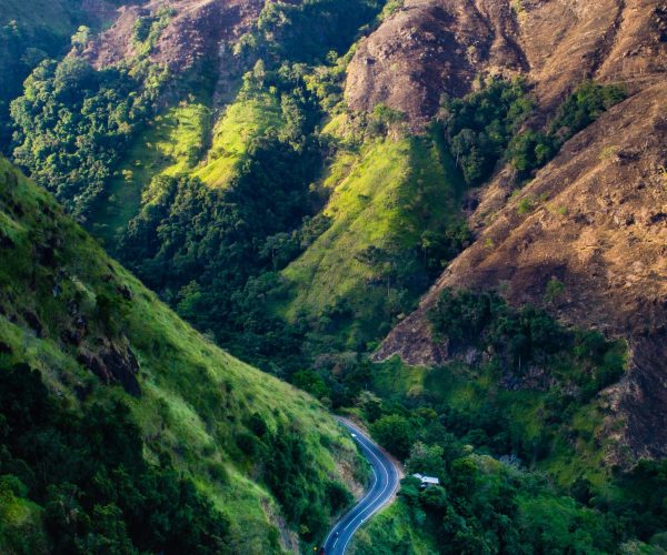
Horton Plains National Park offers a truly unique hiking experience. It’s a mystical, windswept plateau sitting 2,100 meters above sea level. This UNESCO World Heritage Site features a surreal mix of cloud forest and high-altitude grasslands. As a result, it is a haven for wildlife lovers, birdwatchers, and hikers.
The park’s most famous trail is a 9.5-kilometer loop. It takes you to two dramatic escarpments: Little World’s End and World’s End. Here, the land suddenly plunges over 800 meters into the misty valley below. On a clear day, you can see all the way to the southern coast. The trail also passes by Baker’s Falls, a picturesque cascade surrounded by dense forest.
The hike is relatively easy and well-marked, taking about 3 to 4 hours. You should start early, ideally by 6 a.m. This is because clouds often roll in mid-morning, obscuring the views. Entrance fees apply for the national park. The park is best accessed from Nuwara Eliya, which is about a 1.5-hour drive away.
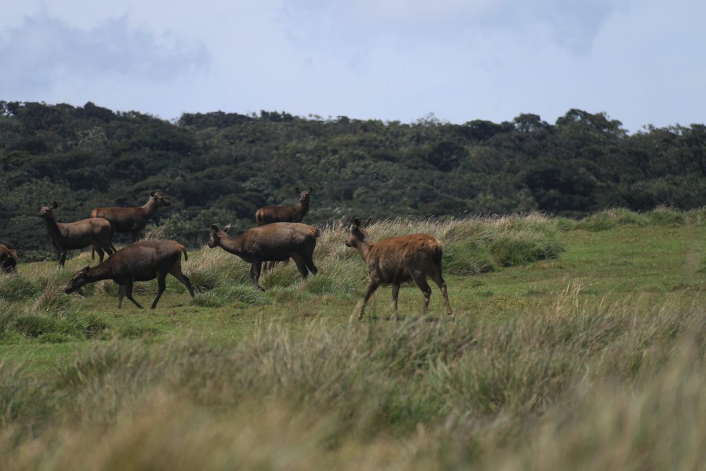
Knuckles Mountain Range – A Biodiversity Wonderland
Location: Central Province, near Kandy Distance: Varies from 8 to 22 kilometers Duration: 3 to 8 hours (or multi-day treks) Difficulty: Moderate to Challenging
Tucked away northeast of Kandy is the Knuckles Mountain Range. It is a rugged, biodiverse paradise named for its resemblance to a clenched fist. This UNESCO World Heritage Site is one of the least explored yet most rewarding hiking destinations in Sri Lanka. Therefore, it is perfect for adventurers craving solitude and untouched beauty.
This highland wilderness is home to misty cloud forests, cascading waterfalls, and remote villages. It also contains over 1,000 species of flora and fauna, many found nowhere else on Earth. Hikes range from gentle walks to strenuous full-day treks across deep valleys.
There are numerous trails waiting to be explored here. However, the most popular routes include the Mini World’s End trail near Meemure and the hike to Knuckles Peak. You can also take multi-day treks from Deanston or Riverston. Some trails wind through remote villages where you can experience traditional Kandyan culture.
Expect changing weather and leeches in the wet season. Most importantly, expect the feeling of being completely off the beaten path. Guides are highly recommended for navigation and to better understand the ecology.
Nearby Stay: Madulkelle Tea & Eco Lodge offers luxury glamping with killer views. Knuckles View Eco Lodge is another good choice.
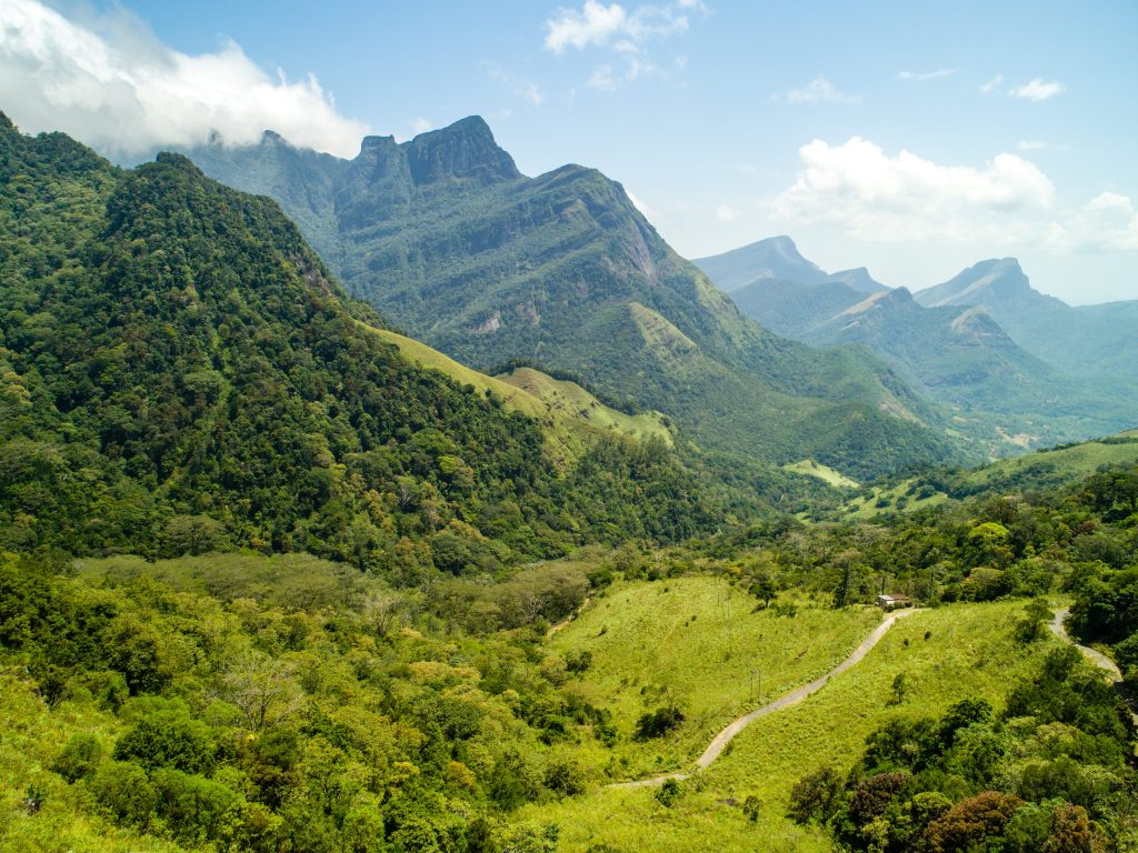
Little Adam’s Peak – A Short But Stunning Ascent
Location: Ella Distance: 2 kilometers one way Duration: 45 to 90 minutes one way Difficulty: Easy
Little Adam’s Peak is a popular and accessible hike in Sri Lanka’s hill country. It offers spectacular views with minimal effort. Named for its resemblance to the sacred Adam’s Peak, this smaller sibling is a short climb that packs a punch!
The trail begins near Ella Flower Garden Resort, just a short walk from Ella town. A well-marked path winds through tea plantations. It then gently ascends via stone steps and dirt trails. In about an hour, you will reach the main viewpoint. Here, panoramic views open up across the Ella Gap and Ravana Falls. For the adventurous, you can continue along the ridgeline to reach even more dramatic lookouts.
This is an ideal hike for all fitness levels and doesn’t require a guide. Sunrise is especially magical. The sky paints the landscape in soft pastels, and mist rises from the valleys below.
Pro tip: Combine this with a visit to Nine Arches Bridge. Time it with a passing train for a full-day Ella adventure. Nearby stay: Ella Flower Garden Resort and Zion View Ella Green Retreat are both close to the trail.
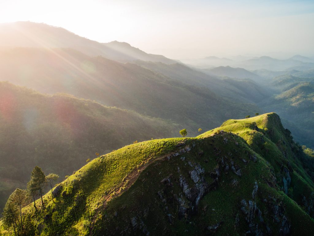
Pidurangala Rock – The Best View of Sigiriya
Location: Near Sigiriya Distance: 1.5 km (one way) Duration: 45 to 60 minutes Difficulty: Easy to Moderate (some scrambling) Best for: Epic views of Sigiriya Fortress
While the famous Sigiriya Rock Fortress is the main attraction, Pidurangala Rock offers the best view of it. Located just north of Sigiriya, this hike provides a breathtaking panoramic view of the fortress. It is a short yet adventurous climb that rewards hikers with sweeping 360-degree vistas.
The trail begins at Pidurangala Royal Cave Temple. A small entrance fee (around $7) helps maintain the temple. The hike takes less than an hour one way. It starts with a steep stone staircase through forested terrain. The final section requires some fun scrambling over large boulders.
At the summit, you are greeted with uninterrupted views of Sigiriya. It is especially stunning at sunrise or sunset. Consequently, it is a favorite spot for photographers and nature lovers.
Pro tip: Wear grippy shoes and go early to beat the heat. Also, bring a flashlight for a sunrise hike. Nearby stay: Aliya Resort & Spa offers jungle luxury with easy access to both sites.
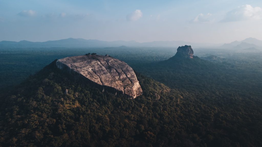
Sinharaja Rainforest – A Walk Through a Living Museum
Location: Southwest Sri Lanka Distance: Varies (2 to 10 kilometers) Duration: 2 to 6 hours Difficulty: Easy to Moderate Best for: Wildlife, rainforest experience
A hike through the Sinharaja Rainforest is unlike any other in Sri Lanka. It’s not about high peaks but about immersing yourself in an ancient ecosystem. As the island’s last viable primary tropical rainforest, Sinharaja is a UNESCO World Heritage Site. It is a biodiversity hotspot teeming with rare flora and fauna. In fact, over 60% of Sri Lanka’s endemic trees live here.
Guided hikes range from short 2-hour walks to full-day treks. Trails wind through dense vegetation, past hidden waterfalls and jungle streams. Along the way, you might spot purple-faced langurs, green pit vipers, and countless insects.
Due to its dense canopy, all treks in Sinharaja must be done with a licensed guide. They will help you interpret the jungle’s many sights and sounds. The forest is often humid, so wear lightweight clothes. Also, bring insect repellent and be prepared for leeches.
Nearby Stay: Rainforest Eco Lodge sits right in the jungle. For another option, consider Blue Magpie Lodge.
Lipton’s Seat – Tea Country Serenity
Location: Haputale Distance: 7 kilometers one way Duration: 2 to 3 hours Difficulty: Easy Best for: Tea plantations, scenic sunrise
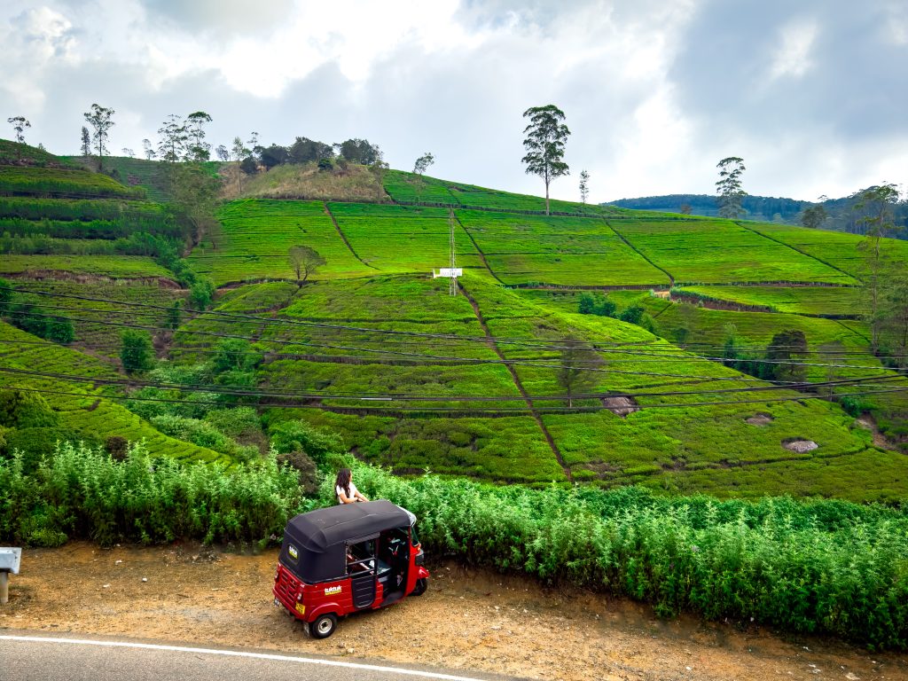
The hike to Lipton’s Seat is one of Sri Lanka’s most scenic trails. It winds through the emerald tea plantations of Haputale. Named after Sir Thomas Lipton, this viewpoint was his favorite spot to survey his vast tea empire.
The trail begins from the Dambatenne Tea Factory and gently ascends for about 7 kilometers. Along the way, you will pass smiling tea pickers at work and Tamil villages. It is not a strenuous hike. Therefore, it’s ideal for a relaxed morning or afternoon walk.
At the summit, you will find panoramic views over five provinces on a clear day. A small café at the top serves warm tea and snacks, adding to the charm. More than just a hike, Lipton’s Seat is a walk through Sri Lanka’s colonial past.
Nearby stay: Thotalagala – Plantations House offers heritage luxury. Alternatively, Amarasinghe Guest House and Olympus Plaza Hotel are good options.
Meemure and Lakegala – The Remote Frontier
Location: Knuckles Mountain Range Distance: Varies Duration: Full-day hike or multi-day trek Difficulty: Challenging Best for: Remote exploration, cultural immersion
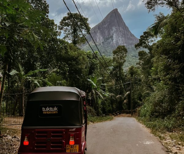
Tucked deep within the Knuckles Mountain Range, the remote village of Meemure is a true off-the-grid paradise. It’s the starting point for one of Sri Lanka’s most adventurous hikes: the climb to Lakegala Rock. Towering like a giant stone blade, Lakegala is steeped in legend.
Reaching Lakegala’s summit is no casual walk. The hike is challenging and steep. For this reason, it is only recommended with an experienced local guide. It involves forest trails, rocky scrambles, and exposed ridges. However, the reward is a jaw-dropping view of the jungle below. For those who do not want to summit, there are gentler hikes around Meemure with swimming spots and waterfalls.
Meemure itself is worth the journey. There is no phone signal and no traffic. You’ll find just traditional Kandyan hospitality and pristine nature.
Pro tip: Pack light, start early, and stay at least one night in Meemure. Nearby stay: Meemure Adventure Camp and other traditional village homestays offer an immersive cultural experience.
Bambarakanda and Devil’s Staircase – A Waterfall Adventure
Location: Ohiya or Kalupahana Distance: 8 to 20 kilometres, depending on route Duration: 5 to 7 hours Difficulty: Moderate to Challenging Best for: Waterfalls and adrenaline-pumping trails
The Bambarakanda Waterfall to Devil’s Staircase hike is a thrilling highland adventure. It combines the country’s tallest waterfall with a heart-racing trail of steep switchbacks.
Starting near Bambarakanda Falls (263 meters), the trail ascends through pine forests. It follows the dramatic path known as the Devil’s Staircase. This rugged trail zigzags up narrow, winding roads. Despite the name, the route is doable for those with good fitness. It can be hiked or even tackled by 4×4. However, walking gives you time to truly soak in the epic scenery.
Expect panoramic views over tea estates, sheer drops, and hidden waterfalls. The trail leads toward Ohiya, where it can connect with other hikes like Horton Plains.
Pro tip: This hike is best done downhill (start at Ohiya, end at Kalupahana). Nearby Stay: Bambarakanda Holiday Resort and Ohiya Gap Hotel offer easy access to the trailhead.
Pekoe Trail – The Ultimate Long Distance Hike
Location: Central Highlands (from Kandy to Nuwara Eliya and Ella) Distance: 300+ kilometers (divided into 22 stages) Duration: 1 to 22 days Difficulty: Moderate (some challenging sections) Best for: Slow travellers, tea trail lovers, long-distance trekkers
The Pekoe Trail is Sri Lanka’s most ambitious long-distance hiking route. It’s a 300+ kilometer journey through the heart of the island’s tea country. Winding from Kandy to Ella, the trail spans 22 stages. It was developed with sustainability and community tourism in mind. As a result, this trail is designed for everyone from day hikers to seasoned trekkers.
What makes the Pekoe Trail special is its blend of natural beauty, history, and local life. You will pass tea pickers at work and visit working factories. The terrain varies from gentle slopes to forested ridges.
Hikers can choose short day walks or tackle multiple stages. Accommodation options range from homestays to historic bungalows. Each stop immerses you in the rhythms of hill country life. The trail is well-mapped, with downloadable GPS tracks at pekoetrails.com.
Suggested Gear Checklist for Hiking in Sri Lanka
Sturdy hiking shoes or trail runners
Headlamp (for early climbs)
Rain jacket or poncho
Reusable water bottle and snacks
Electrolyte tablets or rehydration salts
Sun protection (hat, sunscreen, sunglasses)
Leech socks or repellent
Offline maps (Maps.me, AllTrails, Gaia GPS)
Key Planning Tips
Best Time to Hike
Sri Lanka has two monsoon seasons. Therefore, hiking conditions vary dramatically depending on the region and time of year:
Central highlands (Ella, Nuwara Eliya): Best from December to April.
Southwest (Sinharaja, Adam’s Peak): Avoid monsoon months of May to August.
East Coast and North (Knuckles, Meemure): Best from May to September.
Trail Safety and Navigation
Hiring guides is essential for remote or unmarked trails like Knuckles and Sinharaja. In addition, you should download offline maps like Maps.me or AllTrails. This is because cell signals can be spotty in the hills.
Transportation to Trailheads
Getting to trailheads often involves rural roads or long tuk-tuk rides. Consequently, you should factor in extra travel time. Try to start hikes early in the day to beat the heat and afternoon clouds. In some areas, like Meemure, a 4-wheel drive vehicle may be necessary. Therefore, check with your accommodation or a local guide for the best access options.
Permits and Fees
Permits and fees are required for some parks. Specifically, you will need them for Horton Plains, Sinharaja, and some Knuckles trails.
FAQ
Sri Lanka’s rock climbing scene is still developing, but several locations attract climbers. Yanakala (Dambulla) and Sigiriya area offer climbing friendly rock faces, while Lakegala Rock is known for its vertical ascent, although it is more of a scramble than a technical climb. Ella has bouldering spots and potential for traditional climbing, especially around Ella Rock. For indoor climbing or training, Colombo has a few gyms.
You might also consider downloading the Tuktukrental Travel App. It features offline maps, offbeat recommendations and even helps fellow tuktuk-ers on the road connect for information or a few post-drive beers – or the local Sri Lankan arrack if you are feeling adventurous!

